


Sotheby's International Realty
- 95 Avenue Victor Hugo
- 75116 PARIS, France
- +33 1 40 60 50 00
Sotheby's International Realty
- 50 rue d'Auteuil
- 75016 PARIS, France
- +33 1 56 26 56 55
Sotheby's International Realty
- 82 Avenue de Wagram
- 75017 PARIS, France
- +33 1 46 22 27 27
Sotheby's International Realty
- Place Sainte Foy - 2 Rue de Chézy
- 92200 NEUILLY, France
- +33 1 41 43 06 46
Sotheby's International Realty
- Place Sainte Foy - 2 rue de Chézy
- 92200 NEUILLY, France
- +33 1 41 25 00 00
Sotheby's International Realty
- 37-39 rue de Turenne
- 75003 PARIS, France
- +33 1 48 87 14 41
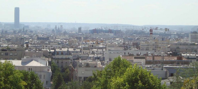
Paris 20
The 20th arrondissement of Paris, located in the eastern part of the capital, is a district rich in history and cultural diversity. Created in 1860 during the annexation of peripheral communes by Paris, this arrondissement has managed to preserve its authentic character while evolving over time. Historically, the 20th has been a working-class stronghold and a welcoming home for numerous waves of immigrants, a fact still reflected today in the social and cultural diversity of its residents.
The architecture of the 20th arrondissement is an eclectic mix of styles, ranging from Haussmannian buildings to quaint townhouses and modern constructions. The neighborhood of Belleville, shared with the 19th arrondissement, is particularly notable for its narrow, winding streets, steep staircases, and individual houses that recall the time when Belleville was an independent village. Ménilmontant, another iconic area, offers a panorama of Paris from its heights and is known for its bohemian and artistic atmosphere. The Père Lachaise Cemetery, one of the most famous cemeteries in the world, is also located in the 20th, attracting visitors from around the globe who come to pay homage to figures such as Jim Morrison, Oscar Wilde, and Édith Piaf.
In terms of real estate, the 20th arrondissement offers a wide variety of housing options, from affordable small studios to large family apartments, as well as lofts converted from former artist workshops. Property prices here are generally more accessible than in other parts of Paris, attracting a diverse population, including young professionals, families, and artists. Recent renovations and developments have also seen the emergence of modern and eco-friendly residences, meeting the expectations of new residents in terms of comfort and sustainability.
The neighborhood life in the 20th arrondissement is dynamic and friendly, with a multitude of local shops, markets, cafes, and restaurants that reflect the area's culinary diversity. The markets of Belleville and Rue des Pyrénées are particularly popular, offering a wide range of fresh and exotic products. Culture is omnipresent, with numerous theaters, independent cinemas, and concert halls enlivening the evenings. The streets of Ménilmontant and Belleville are also known for their numerous bars and live music venues, attracting a young and trendy crowd.
The strengths of the 20th arrondissement are numerous. In addition to its cultural and historical richness, the neighborhood benefits from a well-developed public transportation network, with several metro and bus lines facilitating travel to the rest of the city. Green spaces like Parc de Belleville and Parc de la Butte-du-Chapeau-Rouge provide areas for relaxation and recreation for residents. The strong presence of local associations and community initiatives also helps create a genuine neighborhood spirit, where solidarity and conviviality are at the heart of daily life.
In summary, the 20th arrondissement of Paris is a district where tradition and modernity blend, offering a pleasant and dynamic living environment for its residents. Its cultural diversity, architectural highlights, and vibrant neighborhood life make it a sought-after place to live for those looking to experience an authentic and ever-evolving Paris.
Main lanes
Rue des Amandiers: path in the 17th century, it extended after 1785 beyond the wall of the
Farmers General the rue des Amandiers (Chemin-Vert)
Rue d’Annam: trail of the Starters under the Empire, it took this name in 1877
Rue Auger: path in 1730
Rue de Bagnolet: path crossing the small hamlet of Hondarribia (12 houses in 1750), then the village of Charonne, where it was named rue au Vacher in 1675 then Grand-rue de Charonne and which led to the village of Bagnolet.
N°2: "pig's head" cabaret in 1793, whose sign was a bust of Louis 16
N°10: first houses in the village of Charonne, extending mainly on the south side, the north side being occupied by the domain of the lord of Charonne.
N°109: entrance to the Château de Charonne, which was a considerable estate at the time
N°119: St Germain de Charonne church; rebuilt in the 15th century, it was restored in the 18th century, then in 1820 and 1880. The parish cemetery remains around the church; it is one of only two in Paris. On the terrace in front of the bell tower was the town hall of Charonne, suppressed and razed in 1860
N°148: Hermitage pavilion, remains of the Château de Bagnolet
Rue des Balkans: route aux vaches then chemin de Vincennes in 1731, it ran along the grounds of the Château de Bagnolet
Rue de Belleville: existed in the 17th century and crossed the hamlet of La Courtille, separated in two by the Mur des Fermiers Généraux (Basse and Haute Courtille)
N°8: Famous Taverne Dénoyez under the reign of Charles 10. Replaced by the Folies-Belleville theater
N°13: famous Favié ball
N°94: Ferme de Savy, or Hôtel de Savy, a large 11th century estate of 23 hectares, which disappeared definitively in 1767
N°139: Belleville church and cemetery, from 1548, located in the heart of the village
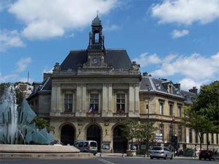
N°141: second town hall of Belleville from 1847 to 1860, then of the 20th arrondissement until 1875
N°160-174: convent of the monks of Picpus from 1638 to the Revolution
N° 213: old manhole of the Lantern of the Belleville aqueduct. Class
N°296 to 324: St Fargeau park (from Ménilmontant castle); disappeared in 1914
Rue Bisson: from the 17th century
Rue du Borrego: old alley in the grounds of Ménilmontant castle
Rue des Cascades: Sente des Musardes in the 18th century, it was transformed into a street in 1837. Two listed gazebos exist at N°17 (des Messiers) and at N°40 (St Martin)
Rue de Charonne: old road leading to the village of Charonne. The first houses appeared around 1600
Old houses at N°12, 15, 21, 23, 35, 37, 50, 61, 62, 65, 87, 89, 116, 121, 128, 155, 165.
N°51 53: Hôtel de Mortagne, built in 1661 and where Vaucanson died in 1782. Listed
N°94 98: Convent of the Daughters of the Cross from 1641 which covered 42 hectares. Demolished in 1906
N°95 99: Convent of ND de Bon Secours from 1648. Occupied from 1802 by a cotton mill belonging to Richard and Lenoir
N°100: Madeleine de Traisnel priory from 1654, demolished in 1857
N°157 161: Dr Belhomme's health center. This hotel of 1700 became a nursing home in 1768 which sheltered during the Revolution against strong remuneration of the suspects that the Doctor declared sick; as soon as they could no longer pay, they were declared "cured", released, arrested, they were most often guillotined. Rue de la Chine: former rue des Hautes Gâtines from the end of the 17th century, it owes its name to a Chinese-style building, which no longer exists today.
N°4: Ménilmontant hospital from 1878, which became Tenon hospital the following year
Rue Courat : indicated from 1730 under the name of Coura
Rue de la Cour des Noues: very old rural path already bearing this name in 1730
N°1: typical house from the Restoration period
Rue de la Croix St Simon: owes its name to the Calvary planted in the middle of the vines in 1731. It disappeared during the Second Empire. Hospital at N°18
Rue Dénoyez: street dating from the Empire whose name comes from the guinguette at
N°8 rue de Belleville
Rue de la Duée: 17th century path in front of its name at a source (une duée)
Rue de l'Elysée Menilmontant: opened during the Second Empire on the site of the public ball of the same name
Rue Envierges: 18th century path leading to the fields of the Ferme de Savy. Its name, from 1837, is due to the locality of the Virgin
Rue de Fontarabie: from the 18th century, it owes its name to a hamlet in the village of Charonne (located at the outlet of rue de Bagnolet). In 1789, out of the 102 houses in the village, there were 16 guinguettes
Rue Galleron: from the 18th century. There was the entrance to a house rented in Charonne by Fouquier-Tinville from 1781.
Place des Grès: former main square of Charonne where was the post of justice of the lords of Charonne as well as the yoke.
Rue des Haies: trail in 1730 (“Petit Charonne path”)
Rue Haxo: former alley in the park of the Château de Ménilmontant since 1834, where it took the name of rue de Vincennes. At N°85 is the Villa des Otages, a former café-concert where 52 hostages were massacred by the Communards on May 26, 1871. A chapel was built there in 1936 in memory.
Rue Julien Lacroix: former crown road from the 17th century. Julien Lacroix had received the surrounding land from King Charles 10
Rue de la Justice: former path of the Cows then of Justice which led to the gibbets of the seigneury of Charonne
Rue de Lagny: chemin de la Pissotte in the 17th century, then chemin de Lagny in the 18th century
Rue Le Bua: half-moon path which served the place called Le Bua in the 18th century
Rue de la Mare: Lane of the Nonnains at the end of the 16th century. At N°36, at the end of the courtyard, is the gaze of La Roquette; arms from 1575 are carved inside. Restored in 1812. Listed
Rue des Maronites: 17th century path, transformed into a street in 1836 under the name of Constantine. It received its current name in 1867
Rue de Ménilmontant: path leading to the hamlet of Ménilmontant, a very small town formed around a mesnil (large rural house), indicated from the 13th century.
N°4: Bal des Armes de France under Charles 10, replaced by the Salle Graffard, a place for political meetings in which Louise Michel often took part. Cinema today.
N°27: Grand Pavilions Ball
N°40: Ball of the Green Bars
N°145: House of Barthélémy Enfantin, Saint-Simonian successor to the founder; he bought this large property, now fragmented, in 1793 and made it the seat of the movement which flourished in the first half of the 19th century.
N°162 168: location of a very large 14th century property
Rue des Montiboeufs: the locality of Montiboeufs existed from the 14th century (mention of 1350) and was served by the Chemin des Bas-Montiboeufs
Rue des Orteaux: breakthrough in 1720 through the cultures of Charonne to allow the Duchess of Orléans to go to her castle of Bagnolet. It was a broad avenue planted with trees called the Avenue de Madame; sold with the park in 1769, it became rue Madame, then des Orteaux in 1869, because at the entrance to the park there was the place called des Orteaux
Villa des Otages: opened in 1928 in memory of the tragedy in rue Haxo
Rue Panoyaux: path crossing the Pas-Noyaux vineyard in the 18th century which was transformed into a street in 1837 then extended in 1863
Chemin du Parc de Charonne: old path planted with trees leading to the facade of the Château de Charonne
Rue des Partants : former Cloche à l’Eau trail which formed the boundary in 1790 of the communes of Charonne and Belleville. Owes its name in the 19th century to a locality
Rue des Pavillons: old road of the stronghold of Maulny which was called Le Pavillon before the 18th century
Rue Pelleport: road linking rue de Belleville to rue de Ménilmontant along the grounds of the Château de Ménilmontant; it was called Charonne until 1868 when General de Pelleport gave it his name.
N°1: Au petit Bonhomme guinguette famous during the first half of the 19th century
N°130: entrance to the large estate of Château de Ménilmontant, which had replaced the stronghold of Maulny. This castle belonged since 1695 to the Le Pelletier de St Fargeau family. In 1763 then in 1786, the estate was reduced, and the daughter of the regicide subdivided the whole from 1802
N°180: Belleville hospice, from 1851
Rue Pierre Bayle: rue de l’Air in 1672, des Rats-Popincourt in 1731, then des Rats until 1897
Rue de la Plaine: old Charonne rural path from the 18th century
Rue Planchat: rue du Bois in 1730
Sentier de la Pointe: rural road in Charonne which led to the locality of the same name in the 18th century
Rue des Prairies: path indicated from 1672 then called du Center de la Cour des Noues, then des Champs. Its current name dates from 1873
Rue de la Py: Py road in the 18th century which led to the locality of the same name.
Rue Ramponneau: former rue l'Orillon in the village of Belleville; in the 18th century there was a famous guinguette run by Jean Ramponneau. Name given in 1867
Rue des Rasselins: locality in the village of Charonne
Rue des Reglises: path in the center of Rasselins from the 18th century which ran along the Clos Réglise
Rue du Repos: rue Saint-André in 1672, it owes its name to the proximity of the Père Lachaise cemetery
N°13: 18th century house with boundary markings from 1724
N°29 and 31: old houses
Rue du Retrait: the Ratrait was a vineyard mentioned in the 16th century. The path led there.
Rue Riblette: one of the four oldest streets in Charonne, mentioned as early as the 16th century, and entirely built in 1672. At N°23, Restoration house
Rue des Rigoles: very old road; the gullies were in the 14th century gutters which led the runoff water towards the manholes of the aqueducts.
Rue des Rondeaux: Baltreux trail from the village of Charonne in 1830, then from a place called Rondeaux
Rue des Rondonneaux: old part of the Center de la Cour des Noues path, called rue des Audriettes at this point. The locality of Les Rondonneaux gave it its name in 1880. The abundant source of La Cloche flowed nearby.
Rue de Savies: path from the end of the 17th century, then rue St Martin and finally rue de Savies in 1869, name of course due to the stronghold of Savy, belonging to St Martin des Champs
Passage des Soupirs: path under the First Empire, then street in 1835 under its current name
Rue du Surmelin: street running to the south along the walls of the Château de Ménilmontant in the 18th century, which had its main entrance there at numbers 1 to 11. From 1790, this was the dividing line between the municipalities of Belleville and Charonne. In 1877, it received its current name (a river of the Marne). The Ménilmontant reservoirs were built in 1865 at N°51
Rue du Télégraphe: old walkway inside the Château de Ménilmontant
N°40: Belleville cemetery: in 1808 the town bought from the daughter of the regicide Le Pelletier part of the grounds of her father's Château de Ménilmontant, which she had begun to subdivide in 1802; the municipality installed its new cemetery there, thus located almost a kilometer from the village. Its beautiful trees are the only remains of the castle park. Before the establishment of the cemetery, Claude Chappe installed his telegraph there in 1792, because this place is the highest in Paris with Montmartre (128 meters).
Rue des Tourelles: from the First Empire, this street owes its name to the turrets of a pavilion located in the park of the Château de Ménilmontant
Rue de Tourtille: existing from the 17th century, it housed under Louis 15 the property of Tourtille-Saugrain, inventor of the street lamps of Paris who had obtained the exclusive rights to light the streets of Paris from 1769 to 1789.
Rue des Vignoles: old path of Charonne called path of Basses-Vignoles, named due to the locality of the end of the 14th century which designated a vineyard.